
The lake was bare of birds as the wind scudded across the surface the birds, and there only seemed to be Mallard around today, were being quite sensible and sheltering behind a wall.
No sign of the Dabchicks or the Tufted Ducks that were there last week.
I sat there thinking, you never know what might appear when a great gust of wind knocked me, and the tripod flying, with the camera end giving me a bang on the head on the way to the ground.
Time for 'Plan B'.
Off to Cawfields thinking that as we were out anyway we might as well have a walk, I just took the camera with me.
The wind at our backs pushed us up Cawfield Crags, and however windy it was a Walltown, it was windier on the tops of the Crags reminding me to say to anyone planning on walking the Hadrian's Wall Path, do it from west to east so you have the prevailing winds behind you.
The footpath men have been to Cawfields with their little green sticks but in my first picture today you can see an area they've repaired, this would have been a groove that's been filled and reseeded.
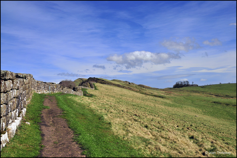
Cawfield Crags with remedial repairs to the Hadrian's Wall Path
It said on tonight's weather forcast that there had been gusts up to 50mph and I could believe that, it was very warm but you had to keep your outer coat zipped up or you were lashed to bits, and in danger of hang gliding over the Crags.

After the ups and downs of Cawfield Crags you eventually reach the road at Caw Gap
From Caw Gap you can continue up onto the slopes of Winshields Crag, you can see the line that was Hadrian's Wall in the picture, we chose to head back to the car park at Cawfields, taking the lower track that runs parallel to the Wall, making a three mile circular walk.

The lower path looking east to the right of the picture you can just see the Vallum
The views from the lower path up to the Wall are quite impressive, if you think the Wall was 6 metres high when it was built.

The view up to Hadrian's Wall from the lower path, at Thorney Doors on Cawfields Crag
There are lots of visitors about, considering it's so early in the season and mid week, more of the wrinkly set, like me and TT, making the most of our retirement time.

Milecastle 42 at Cawfields with views west over the Fort at Aesica and Mucklebank Crag.
We laugh about the silly things that 'Public Works' and an intransigent attitude do in this day and age but obviously it was no different in Roman times, if the Milecastles had to be a Roman Mile apart then that was it written in stone, quite literally.
You can see from this picture how much easier it would have been to move the Milecastle just a bit to west where the land is flatter.
On several of the Forts and Milecastles along the Crags there's a gateway to the north that opens onto a sheer drop, not at all practical but can't you hear an ancient clerk of works insisting 'it's on the plans so that's how we build it'?

I include this view to the south over the Mare nd Foal standing stone just because I like the clouds
We eventually got back to the car park, spent some time watching a Small Tortoiseshell butterfly enjoying the dandelion flowers, and looking for toad spawn before heading bag home with burning faces from the sun and wind but feeling better for the fresh air.
Toilets at Cawfield Quarry, refreshments at The Milecastle In and Herding Hill Farm Shop.
As usual, all photographs used on this blog are copyright of Joan Thirlaway and cannot be used without my written permission.
More photographs at www.joanthirlaway.co.uk
1 comment:
Lovely sky in the fianl image and another good history insight. Keep it up - David
Post a Comment